BEIJING, Nov. 13, 2024 /PRNewswire/ -- Nanjing, an ancient and vibrant city, is welcoming the era of low-altitude drones with a new attitude.
In the sky of Nanjing, drones are becoming more and more frequent. They undertake different tasks: efficient logistics and distribution, adding new vitality to urban commercial activities; Accurate surveying and mapping tasks to provide detailed data for urban planning and construction; Play a key role in emergency relief and buy valuable time to save lives.
The rapid development of unmanned aerial vehicles has gradually transformed from consumer goods to industry operation tools, and the networked unmanned aerial vehicles have also emerged. Networked UAVs get rid of the problems of information silos and limited image transmission, and extend signals with the help of network signals, becoming "eye of the sky" and gradually applied to all walks of life.
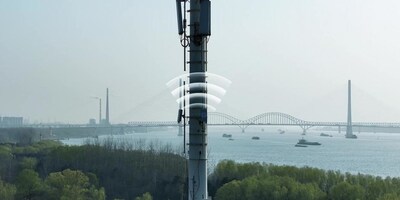
In order to ensure the safety and efficiency of low-altitude flight of networked UAVs, Nanjing has continuously strengthened the construction of low-altitude infrastructure. Based on the different landforms of Nanjing, site solutions are designed according to local conditions to differentiate base station construction solutions in different regions and routes to ensure the continuity of airspace signals. At the same time, multiple experiments and optimizations are performed on the frequencies and tilts of the air-domain base stations in Nanjing. Finally, the RSRP of the air-domain signals in Nanjing is greater than -95 and the SINR is greater than 5, ensuring that the network indicators in different areas and routes can meet the requirements of low-altitude flight.

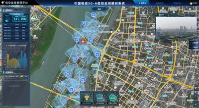
China Telecom has built a 5G UAV integrated management cloud platform based on cloud network resources, e-surfing nebula, which is centered on cloud network edge and end. The platform has an industry-leading 5G UAV flight control system, which can solve problems such as remote control, live image, and data management of UAVs in one-stop mode. It is committed to building a professional cloud platform for UAVs with flight control + industry applications + AI services. It is compatible with all kinds of UAVs and shelters, and manages and controls the UAVs incorporated into the platform in a unified manner. By establishing the UAV application platform, 5G UAVs can implement intelligent supervision and application management of low-altitude flight, which helps standardize UAV flight activities and improve the efficiency and safety of urban governance.
Nanjing Telecom has deeply explored the application of 5G-A millimeter wave in UAV detection and established an advanced low-altitude flight monitoring system to grasp the location and status of aircraft in real time. At the same time, a number of professional low-altitude flight managers and technical personnel have been trained, which has provided solid support for the sustainable development of low-altitude industries.

Based on the above-mentioned UAV industry solution, Nanjing Public Transport's first 5G + "Little Blue Whale" UAV officially took off at the Horse Group Transfer Center and launched its first UAV air cruise. UAV applications in low-altitude public transport scenarios integrate 5G, low-altitude intelligent networking, and digital technologies, and combine them with production factors such as vehicles, lines, and stations to shape new potential energy for development with new productivity.
As an important part of the modernization and three-dimensional security system of urban governance, police aviation provides efficient and intelligent support for urban governance. At present, traditional police work is facing four problems: First, lack of effective understanding of the scene, through intercom and mobile phone can not fully understand the scene; Second, there is a lag in personnel arriving at the site, and personnel cannot reach the site quickly due to environmental and traffic factors. Third, the artificial efficiency is low in complex environments, and there are difficulties in arresting, searching and rescue in mountainous areas and at night. Fourth, the fixed monitoring coverage is limited, there are blind areas, and the site situation cannot be three-dimensionally understood. Therefore, police navigation is of great significance as the development direction of the new era of public security. After long-term exploration with the public security department, a complete solution is summarized. That is, the UAV platform is deployed in the public security department intranet to realize real-time image transmission and ensure data privacy. At the same time, grid-based shelters are deployed in Nanjing, and the nearest shelters are preferentially selected to fly to the police station. At present, 28 million RMB UAV projects have been signed with the public security.
Nanjing, the city of low-altitude drones, is leading the new trend of urban development with its unique charm and innovative spirit. It is believed that in the future, with the continuous progress of technology and the continuous expansion of applications, low-altitude UAVs will bring more surprises and opportunities to Nanjing.
Photo - https://mma.prnewswire.com/media/2556428/A_based_UAV_network_connection_private_network_enabling_city_future.jpg
Photo - https://mma.prnewswire.com/media/2556429/image_5032577_27344132.jpg
![]() View original content:https://www.prnewswire.co.uk/news-releases/5g-a-based-uav-network-connection-private-network-enabling-the-city-of-the-future-302304001.html
View original content:https://www.prnewswire.co.uk/news-releases/5g-a-based-uav-network-connection-private-network-enabling-the-city-of-the-future-302304001.html

